")
")
")
Features
Download
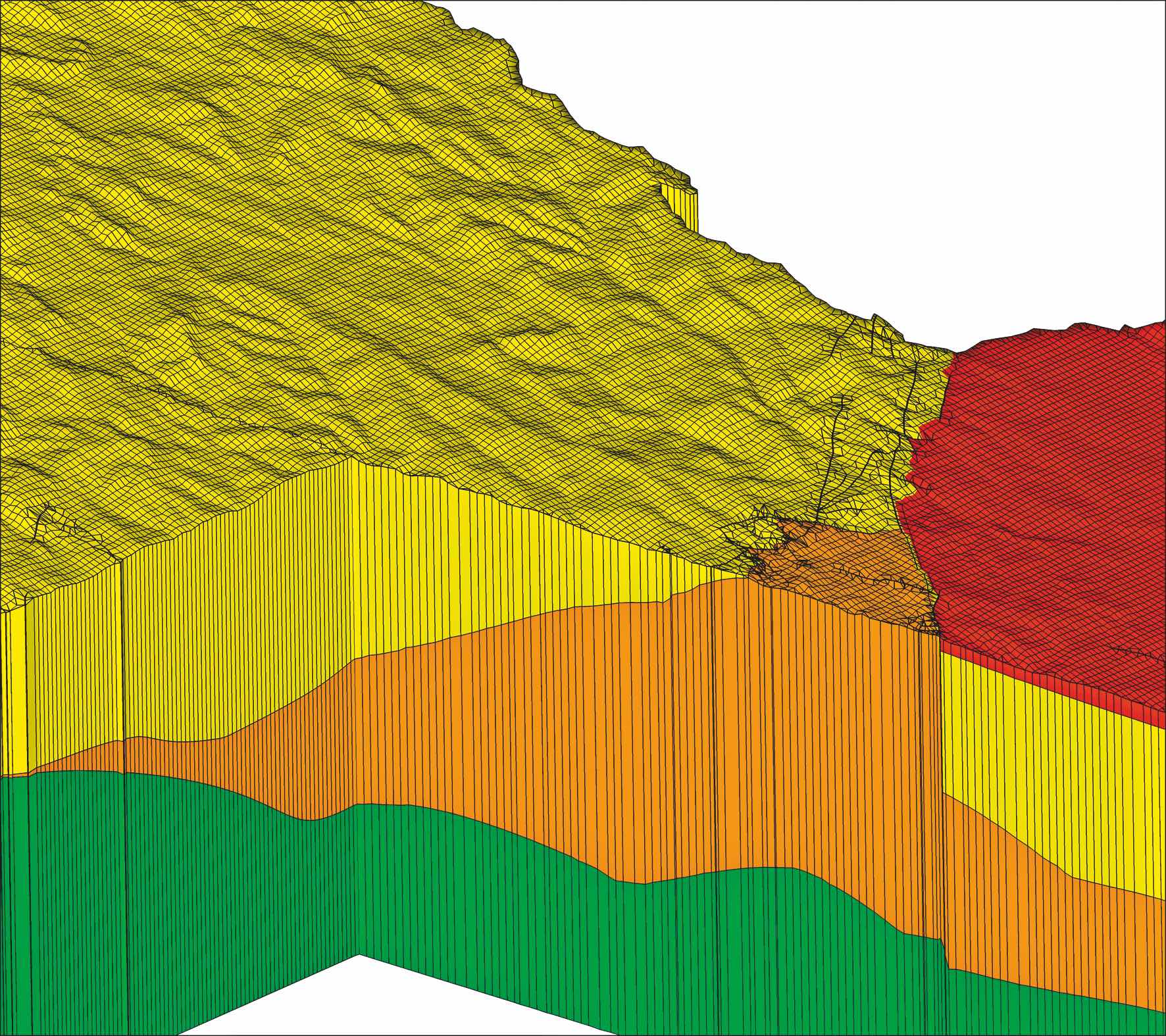
Outcropping geological units
Outcropping geological units are supported by the automatic merging of finite element layers in (vertical) 2-D and 3-D models. This feature allows the accurate representation of complex geological and topographic features. A significant reduction in node and element numbers, especially in locally-refined mesh, ensures optimised CPU times whilst the merging of element layers maximises numerical stability.
Geological unit:
 Mittlerer Buntsandstein/Kreuznacher Schichten
 Rotliegendes/Karbon(Stefan)
 Karbon(Westfal)
 Devon
Devon
Coupling an de-coupling of local mesh / subdomains
SPRING can generate locally-refined models within a regional model to optimise updates, or to allow mesh refinement or scenario calculations.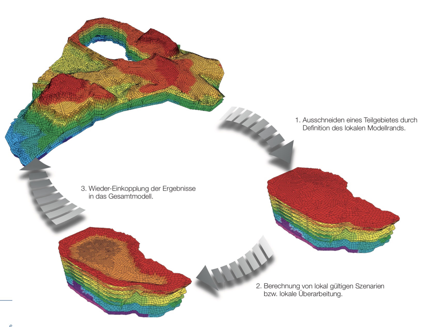
Integration of tunnels and mine voids
A wizard allows tunnels and mine voids to be quickly and easily integrated into 3-D models. Potential changes in element layers or topography are automatically recognised, ensuring the realistic representation of tunnels and voids.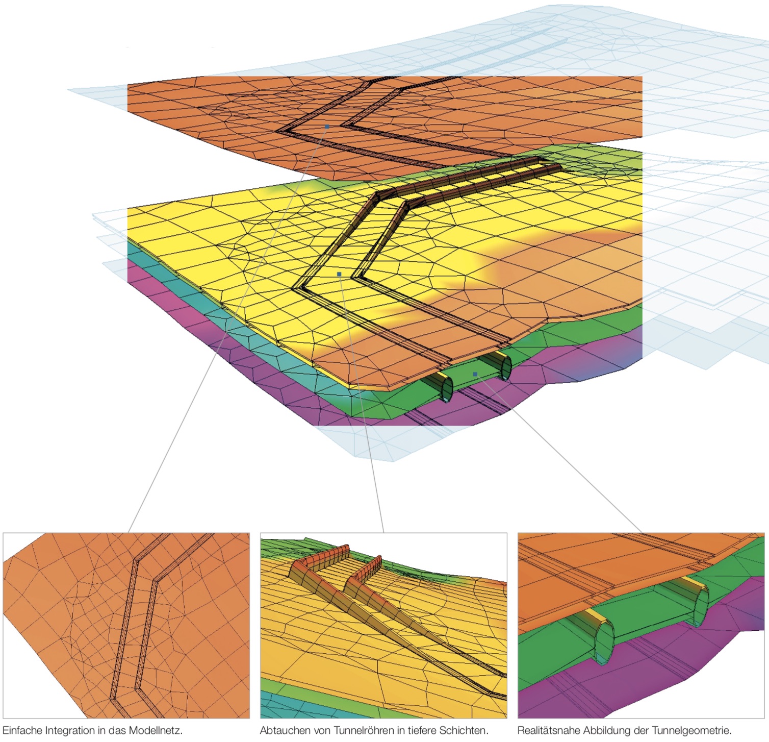

Do you have any questions or suggestions? Send us an email or give us a call.
NEWS
Geotherm Offenburg
March 02, 2018
Happy New Year !!!
January 01, 2018
The 12th SPRING User Conference
December 02, 2017
BUSINESS HOURS
We are available by phone at:
Mo. - Fr.: 08:30 to 17:30
Mo. - Sa.: by appointment